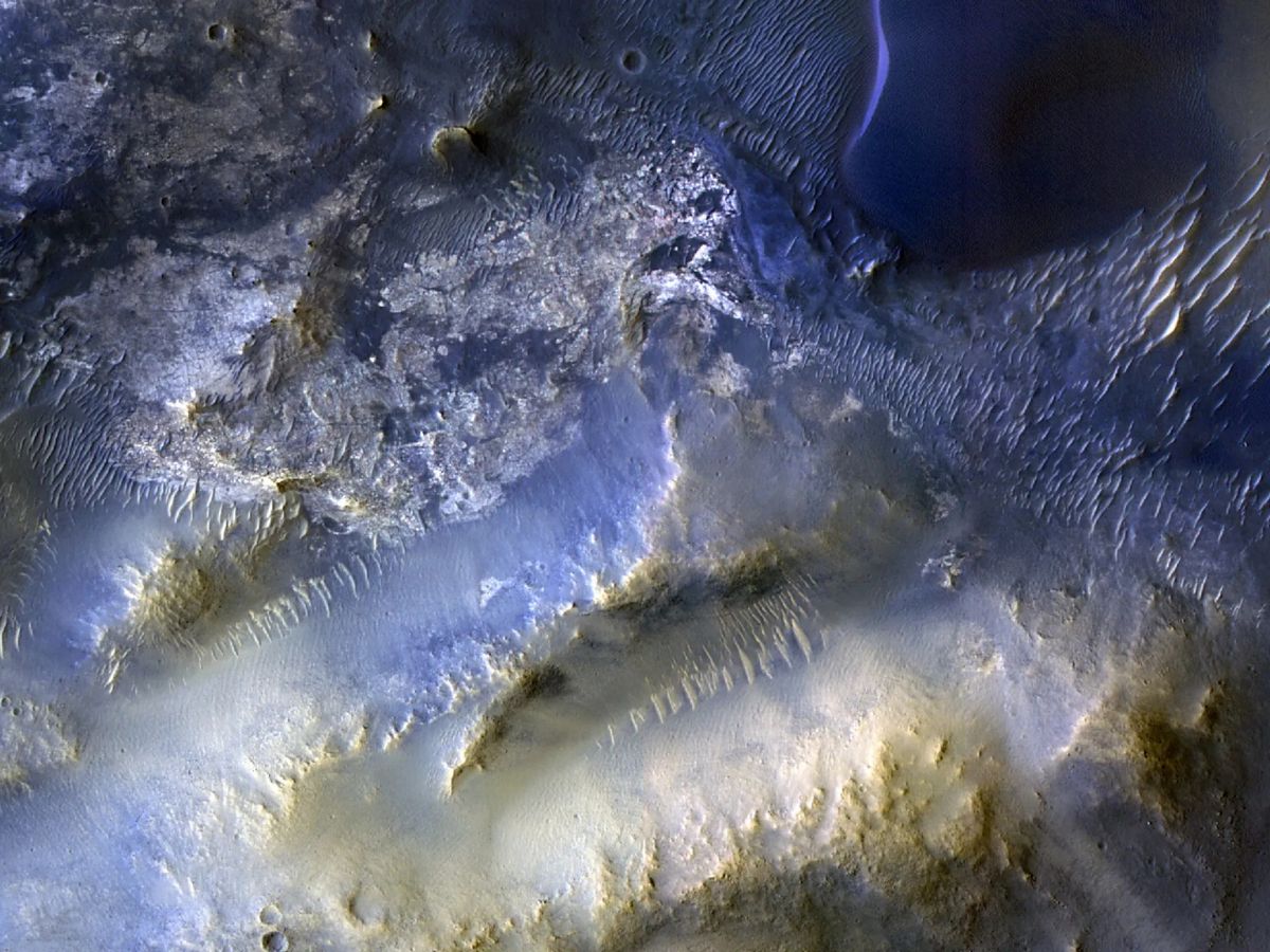
NASA has reached a major milestone in its long-running effort to map and understand Mars. The Mars Reconnaissance Orbiter (MRO) has now captured its 100,000th image of the Red Planet using HiRISE, the spacecraft’s powerful High Resolution Imaging Science Experiment camera. The landmark shot focuses on Syrtis Major, a striking region known for dramatic surface patterns that can reveal how Mars has changed over time.
MRO began its journey from Earth on August 12, 2005, and entered Mars orbit in March 2006. Nearly two decades later, it continues to deliver some of the sharpest orbital views ever taken of another planet. The 100,000th HiRISE image was recorded on October 7, highlighting just how productive the orbiter remains after years of continuous science operations.
The featured location, Syrtis Major, sits roughly 50 miles (80 kilometers) southeast of Jezero Crater, the area currently being explored on the ground by NASA’s Perseverance rover. That proximity makes the new image especially interesting for planetary scientists who are building a fuller picture of Mars by combining rover-level observations with detailed orbital reconnaissance.
In the HiRISE view of Syrtis Major, mesas and wind-shaped dunes take center stage. These are exactly the kinds of landforms HiRISE routinely targets, along with impact craters and ice deposits. Each crisp image helps researchers trace the forces that sculpt the Martian surface—especially wind, which remains one of the most active agents reshaping the planet today.
One mystery still stands out in this scene: scientists haven’t yet pinned down where the windblown sand that formed the dunes originated. Future analysis may help identify its source and explain how sand is transported across this region—clues that can reveal past and present environmental conditions on Mars.
Beyond the impressive number, this milestone underlines HiRISE’s ongoing value to Mars exploration. By tracking surface changes and capturing high-resolution details across the planet, MRO supports everything from long-term climate and geology studies to practical mission planning, including evaluating safer landing sites. As NASA continues preparing for the next phases of Mars exploration—and ultimately future human missions—HiRISE imagery remains one of the most important tools for understanding what kind of world Mars is, and how it continues to evolve.


