Garmin is adding a new layer of depth to its fitness ecosystem with 3D Maps in the Garmin Connect app—but the feature is exclusive to Garmin Connect+ subscribers. Rolled out as part of a broader November 2025 update, 3D Maps brings immersive, three-dimensional topographic detail to your routes and activities, helping runners, cyclists, and hikers visualize elevation and terrain before they head out or when reviewing a workout.
What 3D Maps does
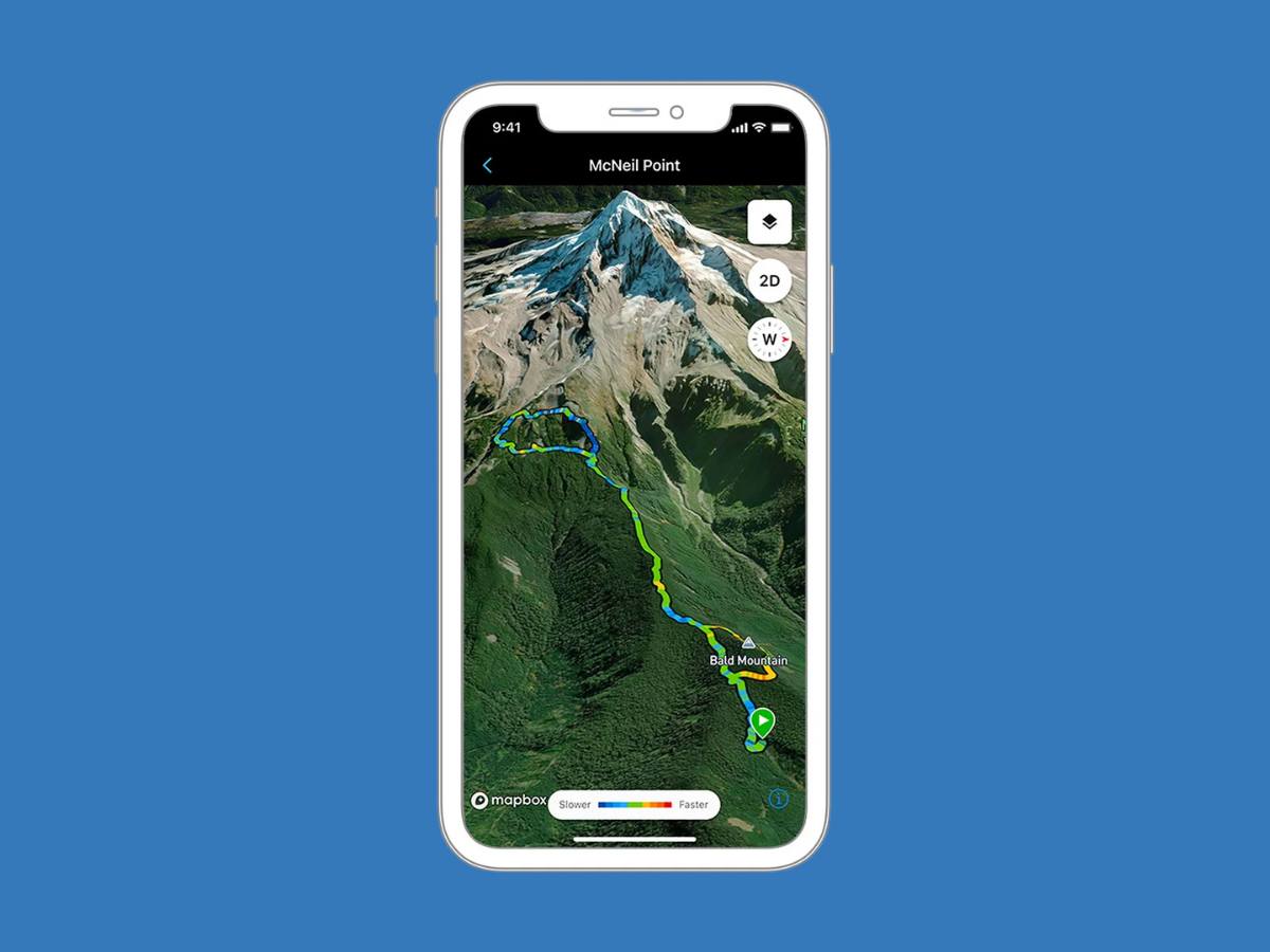
– Displays three-dimensional topographic views for courses, trails, and logged activities
– Helps you understand climbs, descents, and terrain changes that can influence pacing, effort, and gear choices
– Aims to improve route planning and post-activity analysis for performance-minded users
Connect+ is Garmin’s premium subscription, introduced in March 2025, and 3D Maps joins a growing list of paid features designed to give deeper training insight. Pricing is $6.99 per month or $69.99 per year.
What you get with Garmin Connect+
– AI-driven insights that interpret your health and activity data for smarter training decisions
– A performance dashboard to monitor key metrics and trends over time
– Live activity summaries with real-time heart rate, pace, and other critical stats
– Access to premium coaching plans with Garmin Run Coach, Garmin Cycling Coach, and Garmin Fitness Coach
Availability
– 3D Maps is included in the November 2025 update for the Garmin Connect app
– The feature is reserved for Connect+ subscribers and works with compatible Garmin devices
– Arrives alongside wider platform updates for current devices, including popular cycling computers
For athletes who train with elevation and terrain in mind, 3D Maps makes course planning and post-ride or post-run analysis more intuitive. If you’ve been considering Garmin Connect+ for its coaching and analytics, the arrival of 3D mapping adds another compelling reason to upgrade.